CONTACT
DOWNLOADS
- Brochures - download - PREVIEW
- Brochures - download - PREVIEW
- Maps
- High resolution photos
- Calendar of events
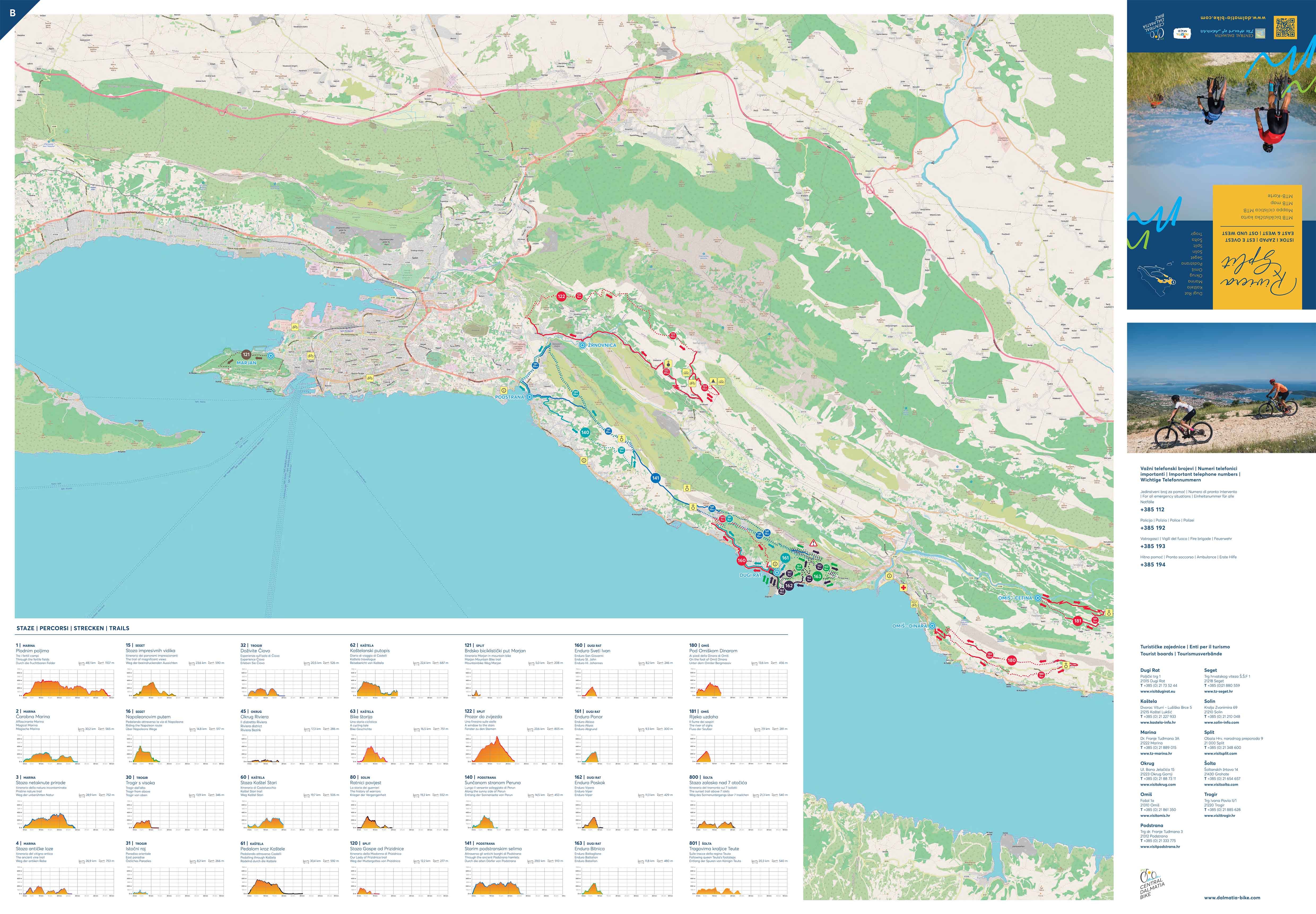
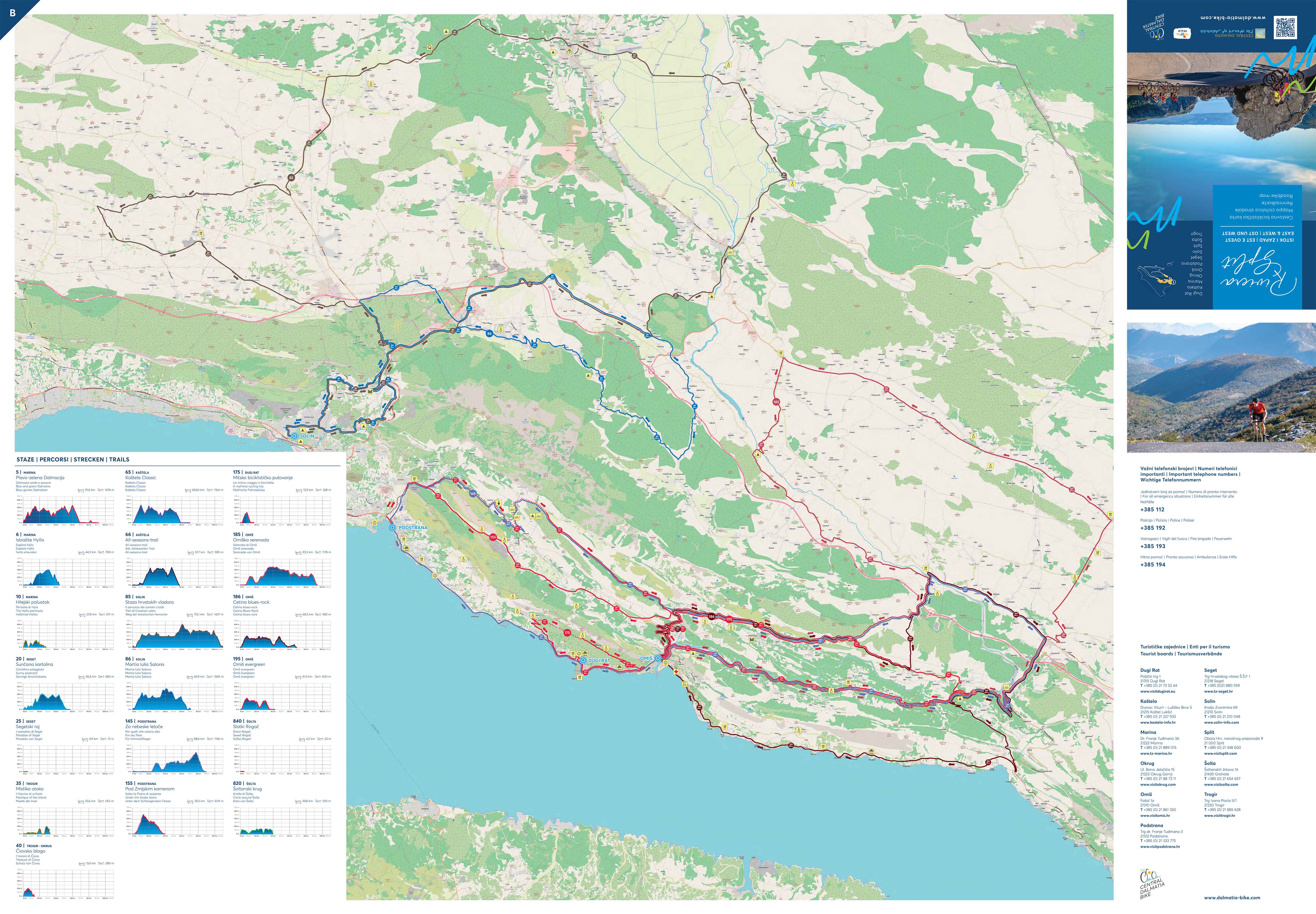
The area of the Dugi Rat municipality stretches towards Omiš. Jesenice, Zeljovići, Krug and Duće on the Adriatic coast, in an area 15 km away from Split are the oldest settlements located at the foot of Perun, a hill named after the Slavic god of thunder and lightning. Built at altitudes of 200 to 250 metres above sea level, their history, dating back to the Stone Age, is told by archaeological finds in the Turska peć and Ponistrice caves. Unlike them, Dugi Rat is the youngest place to emerge right on the coast, around the former Fabrika, a factory built between 1912 and 1913 and opened on March 14, 1914. The connection with the sea was almost non-existent until the end of the 19th century, but now Jesenice gradually descends and expands towards the indented coast, gorgeous bays and hidden natural beaches. The feast of St. John the Baptist is celebrated in June in Greben, at the triple border of Krug, Mali Rat and Dugi Rat, from where there used to be a view over the vineyards. In the saint’s honour and protection, a small church was built here in 1929 on the site of an older, 11th century one, which was renovated in 1982.
Route nummer: 160
Route name: Enduro St. John
Physical difficulty: 2
Techical difficulty: 4
Itinerary: Dugi Rat, Jesenice, Sv.Ivan, Dugi Rat
Points of interest: St. Roch's Church, St. John's Church, St. Marcus's Church
Starting point: Dugi Rat, centre, public car park
Length: 8,2 km
Altitude: 246 m
Longest climb: Put sv. Roka-4 km | 5,9% | 236 m
Longest downhill: Ponor- 2,1 km | -11,1%
Riding time: 0:30 - 1:00 h
Asphalt: 50%
Macadam: 50%
A short ride along the road by the sea leads you to the beginning of a long and gentle 4 km long climb with an average slope of 5.9%, which is the same as on the Dugi Rat Enduro Ponor (Abyss) trail. The first half of the climb is an asphalted road, while the second half is fine macadam. The ascent is a constant slope without steep parts that will not pose any great challenge for climbing even on enduro bikes. After the climb, the first part of the descent is ridden on a macadam road, while the second part is a real enduro descent on a narrow single-track with a number of technical elements such as sharp digged turns, small jumps and drops, large and small stones, possible muddy segments, etc. Steep slopes make the descent even more difficult and go down to -20%. An MTB or E-MTB with a long travel suspension is recommended due to the technical difficulty of the final descent.
The widely known kilometre-long sandy beaches Duće and Jesenice with their unique wooden sailboats hide an unusual history that begins far from today's shores, in the hinterland between the sea and Zamosorje. There, above the hamlet of Zeljovići, is the Pećina or Turska peć cave, an important prehistoric site that preserves the oldest known traces of human life in the area of Poljica-Omiš. About a hundred metres down, towards the west, there is another smaller cave, called Ponistrice, in the foundations of which a flint tool was found, testifying to the presence of man from the Lower Palaeolithic.
In the past, inhabitants of the Poljica area built fortifications on the heights for their safety, and in so doing were able to supervise the surrounding areas. In Jesenice and Duće on the slopes of Mount Perun, there was not much arable terrain and the land was mainly owned by the Archdiocese of Split and the nobles from Split and Omiš, so settlements were carefully compacted and built in rows, preserving the fertile soil. The Immaculate Virgin Church in Jesenice, with a clock on the facade, obtained its altar as a vow from one of the local residents.
Route nummer: 161
Route name: Ponor (Abyss)
Physical difficulty: 2
Techical difficulty: 5
Itinerary: Dugi Rat / Jesenice / Stare Duće / Dugi Rat
Points of interest: St. Roch's Church, St. John's Church, St. Marcus's Church
Starting point: Dugi Rat, centre, public car park
Length: 9,2 km
Altitude: 300 m
Longest climb: Sveti Roko - 5,46 km | 5,1% | 287 m
Longest downhill: Ponor- 1,7 km | -16,1%
Riding time: 0:30 - 1:00 h
Asphalt: 45%
Macadam: 55%
A short ride along the road by the sea takes you to the beginning of a long and gentle 4 km climb with an average slope of 5.9%. The first half of the climb is an asphalt road, while the second half is on fine macadam. The climb is of a constant slope without steep parts and will not pose any great challenge for climbing even on enduro bikes. After the climb, you will be riding through undulating terrain with changes in the surface from macadam to concrete paths and roads until the beginning of the descent. The Ponor (Abyss) descent is an extremely demanding descent of enduro characteristics with a number of technically demanding components such as smaller and larger drops, jumps, loose and large stones (larger than the size of a fist), sharp turns and an average slope of -20.7% in the second part. A MTB or E-MTB with a long travel suspension is recommended.
After more than 400 metres of Mosor's coastal headland is an exceptional mountain relief with all the features of bare karst, which closely follows the Adriatic coast. The stony ridge composed of Cretaceous limestone slopes steeply leans down to the southwest, where it rests on flysch deposits at heights of 250 to 300 metres. Loose soil was brought from the flysch slopes into the sea bays, from which the sandy beaches on the coast were formed, and along which the four capes form a line: Mutogras, Krilo, Mali Rat and Dugi Rat, after which the largest settlement is named, from where the sandy beach stretches for three kilometres, all the way to the border of Omiš which is of exceptional natural value. Along with the aromas of the Aleppo pine, the natural vegetation of the entire area abounds with the beneficial scents of aromatic herbs.
In Duće, St. Anthony is celebrated in June, and Our Lady of the Snow with a large procession takes place in August, as a memorial to the day when snow covered the town in the middle of summer. Of the early medieval churches, worth noting are St. Andrew na Obliku, St. Maxiumus with its medieval cemetery and Our Lady of the Snow in Stomorica above Duće. As well as this, you will also find a gastronomic landmark here, the traditional soparnik, a dish made with Swiss chard, onion and olive oil, which is prepared on large round wooden boards and baked in the fireplace!
Route nummer: 162
Route name: Viper
Physical difficulty: 3
Techical difficulty: 4
Length: 11,3 km
Altitude: 429 m
Points of interest: St.Anthony's Church
Starting point: Dugi Rat, centre, public car park
Itinerary: Dugi Rat(st. Industrijski put)-Put Stare Duće path-Stare Duće-Zagrad-Dugi Rat
Riding time: 0:30 - 1:00 h
Longest climb: Put Stare Duće path-3 km|7,5%|224m
Longest downhill: Poskok/Viper-2 km|-13,6%
Asphalt: 25%
Macadam: 75%
After a short road ride, the trail begins to climb at the end of the 1st kilometre after branching off onto a macadam road. The macadam road widens and narrows often, and the profile of the trail itself is undulating up to 3.5 km, where it begins a constant climb up to the top, which is 3 km long and has an average slope of 7.5%. The beginning of the climb is on a macadam road that narrows into a single track and later joins the road having a constant slope. Part of the descent is ridden on a macadam road, while the main part is an enduro descent with a number of technical elements. There are drops and jumps on the trail that can be bypassed by the surrounding easier roads so that everyone can ride through the descent, but the more skilled cyclists will definitely have fun. The average slope of the central part of the descent is -25%, which means that you should definitely approach with caution because it is a rather demanding descent. The last 2 km of the trail are ridden along the road back to the starting point. A MTB or E-MTB with a long travel suspension is recommended.
The longest series of sandy beaches in Croatia is located in the area of Dugi Rat. The attractive, but at the same time very accessible, beaches of Dugi Rat have been formed for centuries, and today attract the lovers of beauties that sandy beach offers from all over the world. Over its course, the Cetina River brought sand to the sea, to its mouth near Omiš, which was, blown by the wind and sea currents and deposited along the coast below Duće all the way to Dugi Rat, so that the western winds would bring it back to the opposite side and pile it up there, creating an area of shallow water that extends up to 400 metres from the shore. The natural features of these regions are accompanied by valuable cultural sights. St. Anthony’s Parish Church in Duće, dating back to 1864 was built on the site of a chapel mentioned in 1748. Its interior was painted in the 20th century, on the side walls are St. John the Baptist and St. Peter, and at the triumphal arch St. Cyril and Methodius with St. Anthony in the middle. The altarpiece of the main altar is a masterpiece painted by Vlaho Bukovac in Paris in 1886. Alongside the Virgin and Child, St. Stephen and St. Anthony in the foreground, the kneeling figure of St. Stephen appears.
Route nummer: 163
Route name: Battalion
Physical difficulty: 3
Techical difficulty: 4
Length: 11,8 km
Riding time: 0:45 - 1:15 h
Points of interest: the Dugi Rat lookout point
Starting point: Dugi Rat, centre, public car park
Itinerary: Dugi Rat - Stare Duće - Dugi Rat
Altitude: 480 m
Longest climb: Put Stare Duće path - 3 km | 7,5% | 224 m
Longest downhill: Duće - 1,3 km | -16,5%
Asphalt: 30%
Macadam: 70%
The trail uses the same climb as the Dugi Rat Enduro Poskok (Viper) trail, which means that it already begins to climb at the end of the 1st kilometre after separation from the macadam road. The macadam road often widens and narrows, and the profile of the trail itself is undulating up to 3.5 km, where it begins a constant climb to the top, which is 3 km long and has an average slope of 7.5%. The beginning of the climb is on a macadam surface that narrows into a single track and later joins the road and has a constant slope. The main part of the trail comes in the form of a technically extremely demanding descent of enduro characteristics with an average slope of -25%, which is used for the purpose of enduro training and competition. A number of technical elements and very rough and demanding terrain await you. An MTB or E-MTB with a long travel suspension is recommended.
The sandy beaches of Dugi Rat have surpassed all other Croatian sandy beaches by kilometres, and owe their beauty to the unusual natural relief. Mutogras, Krilo, Mali Rat and Dugi Rat are four natural headlands that separate the sea bays into which the streams occasionally deposited loose soil from the flysch slope, and from which the sandy beaches were formed. The coastal slope of the Mosor mountain, a rocky ridge with sparse vegetation, rises to over 400 metres above the coastline where Duće, Dugi Rat and Jesenice are located. Next to Duće is an old coastal village with about twenty houses, Stare Duće, where it is definitely worth looking for the local churches. St. Marcus is decorated with a four-leaf rosette on the front with a bell gable and a broken arch which dates back to 1458, the oldest among the Poljica churches. It was built on the border between two tribes, Duće and Jesenice. Until the construction of the new church, it served as a parish church, and then as a cemetery from 1864. That is when the church of St. Anthony of Padua was built on the site of an older one. Its facade with a bell gable for three bells faces south, and wall paintings adorn the interior walls and barrel vault. In 1939, a belfry with a pyramidal end was built on the rear side.
Route nummer: 175
Route name: A mythical cycling trip
Physical difficulty: 4
Techical difficulty: 4
Length: 16 km
Points of interest: Dugi Rat, Jesenice, Stare Duće
Starting point: Dugi Rat
Itinerary: Dugi Rat, Jesenice, Zeljovići, Stare Duće, Duće, Dugi Rat
Altitude: 340 m
Longest climb: 4 km
Longest downhill: 4,6 km
Riding time: 2:00 h
Asphalt: 100%
Macadam: 0%
When it comes to configuration this is a simple trail with one climb, one descent and a ride along a straight road by the sea. However, with 16 km and a 333 m altitude difference, it belongs to the more demanding trekking trails, although the 3.4 km long climb is not too demanding because the average gradient is 6.3%, which is easy to overcome on a trekking bike with a compact crankset. At the start, the wide road narrows by turning towards Jesenice, and the traffic density is very low. Breath-taking views of the sea open up on a number of hairpin bends, and the gradient is a constant 6%, which means that it is easy to find a climbing pace. Most of the surface is asphalt with a few sections of fine macadam. The most difficult section is at the entrance to Stare Duće, where a short section of 400 m with an average gradient of 7% awaits you. The descent is not demanding and has very similar characteristics to the climb, but hairpin bends should be ridden with increased caution. At the 12th kilometre, near Omiš, the trail joins the main road again leading back to the starting point in Dugi Rat. A trekking bike is ideal for this trail, but it can also be managed on gravel and MTB bikes.
 +385(0)21 73 53 81
 +385(0)99 673 85 43
![]() +385(0)21 73 40 96
+385(0)21 73 40 96
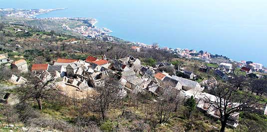
One of the old villages in surroundings of Dugi Rat in the foot of Mt Mošnjica is Staro Duce where there are nice old preserved stone houses. All of these villages follow the same pattern; they all have streets, roads, small squares, centres that are mostly in the vicinity of the church or school, and fileds. Each village boasts some historic monument. Some have churches more than 200 years old, old village cemeteries, belltowers. Surrounded by luxuriant vegetation, far from the city noise or any industry whatsoever, enjoying non-polluted air, mild climate and above all a magnificent view of the sea and islands (Brac, Hvar, Solta), they are something that every tourist will be impressed by at first sight ...
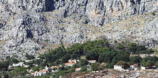
One of the old villages in surroundings of Dugi Rat in the foot of Mt Mošnjica is Krug where there are nice old preserved stone houses. All of these villages follow the same pattern; they all have streets, roads, small squares, centres that are mostly in the vicinity of the church or school, and fileds. Each village boasts some historic monument. Some have churches more than 200 years old, old village cemeteries, belltowers. Surrounded by luxuriant vegetation, far from the city noise or any industry whatsoever, enjoying non-polluted air, mild climate and above all a magnificent view of the sea and islands (Brac, Hvar, Solta), they are something that every tourist will be impressed by at first sight ...
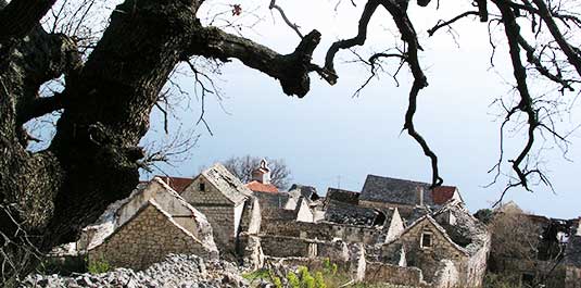
One of the old villages in surroundings of Dugi Rat in the foot of Mt Mošnjica is Zeljovići where there are nice old preserved stone houses. All of these villages follow the same pattern; they all have streets, roads, small squares, centres that are mostly in the vicinity of the church or school, and fileds. Each village boasts some historic monument. Some have churches more than 200 years old, old village cemeteries, belltowers. Surrounded by luxuriant vegetation, far from the city noise or any industry whatsoever, enjoying non-polluted air, mild climate and above all a magnificent view of the sea and islands (Brac, Hvar, Solta), they are something that every tourist will be impressed by at first sight ...
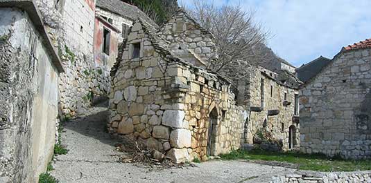
One of the old villages in surroundings of Dugi Rat in the foot of Mt Mošnjica is Jesenice where there are nice old preserved stone houses. All of these villages follow the same pattern; they all have streets, roads, small squares, centres that are mostly in the vicinity of the church or school, and fileds. Each village boasts some historic monument. Some have churches more than 200 years old, old village cemeteries, belltowers. Surrounded by luxuriant vegetation, far from the city noise or any industry whatsoever, enjoying non-polluted air, mild climate and above all a magnificent view of the sea and islands (Brac, Hvar, Solta), they are something that every tourist will be impressed by at first sight ...